1856 Map of Natchez Slave Market Now Online
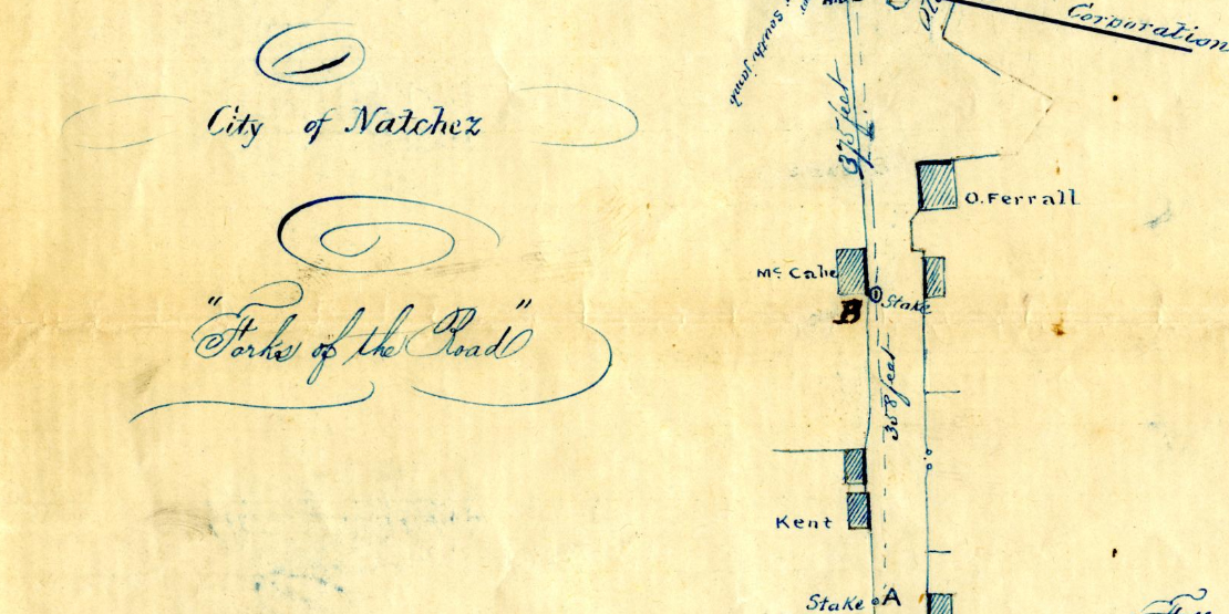
A hand-drawn 1856 map of the second largest slave market in the United States during the nineteenth century is now available on the MDAH Digital Archives. Shown is the Forks of the Road site at the intersection of what was then Washington Road and Old Courthouse Road in Natchez. The image is part of Series 2051: Natchez Municipal Records, 1795–1982.
The map, drawn by Natchez city surveyor Thomas Kenny, shows the city of Natchez corporation line and the names of the slave market buildings: Elam, James, O. Ferrall, Kent, and McCabe. The back of the map reads “Survey of St. Catherine St. at Forks of the Road Aug. 1, 1856.”
Kenny, a native of Galway, Ireland, became a naturalized citizen in 1854. He was elected as Justice of the Peace in Adams County in 1860. He died in Natchez in 1867. An 1853 map illustrating the slave markets at the Forks of the Road site, the earliest of its kind, was also drawn by Kenny and is housed at the state archives.
Natchez was the most active slave trading city in the state and fourth richest city in the United States. Nevertheless, evidence shows the enslaved people in Natchez engaged in countless acts of resistance to their conditions. After achieving freedom in Natchez in July 1863, hundreds of formerly enslaved African Americans sought refuge at the Forks of the Road. The United States Colored Troops established a camp at the site in 1863.
Today, the Forks of the Road site, located at the intersection of Liberty Road, Saint Catherine Street, and Devereaux Street in Natchez, tells the story of the slave trade and the men, women, and children bought and sold there. Learn more about the Forks of the Road on the Mississippi History Now website.